
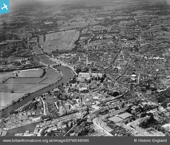
EPW048086 ENGLAND (1935). The River Severn and the city, Worcester, from the south-east, 1935
© Copyright OpenStreetMap contributors and licensed by the OpenStreetMap Foundation. 2026. Cartography is licensed as CC BY-SA.
Nearby Images (14)
EPW048086

EPW000202

EPW005412

EPW000201

EPW005413

EAW003990

EPW001305

EAW046117

EPW000398

EPW041739

EPW041768

EPW034600

EPW041738

EAW003653

Details
| Title | [EPW048086] The River Severn and the city, Worcester, from the south-east, 1935 |
| Reference | EPW048086 |
| Date | June-1935 |
| Link | |
| Place name | WORCESTER |
| Parish | |
| District | |
| Country | ENGLAND |
| Easting / Northing | 385076, 254233 |
| Longitude / Latitude | -2.2183165703164, 52.185737710479 |
| National Grid Reference | SO851542 |


