
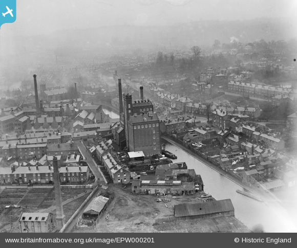
EPW000201 ENGLAND (1920). Albion Flour Mills and Royal Porcelain Works, Worcester, 1920
© Copyright OpenStreetMap contributors and licensed by the OpenStreetMap Foundation. 2026. Cartography is licensed as CC BY-SA.
Nearby Images (6)
EPW000201

EPW005412

EPW005413

EAW046117

EPW048086

EPW000202

Details
| Title | [EPW000201] Albion Flour Mills and Royal Porcelain Works, Worcester, 1920 |
| Reference | EPW000201 |
| Date | February-1920 |
| Link | |
| Place name | WORCESTER |
| Parish | |
| District | |
| Country | ENGLAND |
| Easting / Northing | 385087, 254106 |
| Longitude / Latitude | -2.2181500693964, 52.184596101291 |
| National Grid Reference | SO851541 |
Pins

Class31 |
Monday 18th of February 2013 03:44:50 PM | |
|
Class31 |
Monday 18th of February 2013 03:44:19 PM | |
|
Class31 |
Monday 18th of February 2013 03:43:55 PM | |
|
Class31 |
Monday 18th of February 2013 03:43:21 PM | |
|
Class31 |
Monday 18th of February 2013 03:38:29 PM |
User Comment Contributions
Can see the house where I was born ! |

jeanniebelle |
Tuesday 3rd of July 2012 12:33:06 PM |