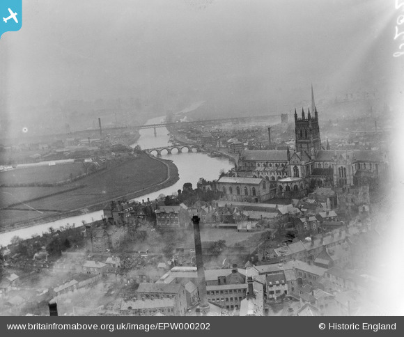
EPW000202 ENGLAND (1920). Worcester and Cathedral, Worcester, from the south-east, 1920
© Copyright OpenStreetMap contributors and licensed by the OpenStreetMap Foundation. 2026. Cartography is licensed as CC BY-SA.
Nearby Images (20)
EPW000202

EPW048086

EAW003990

EPW001305

EPW005412

EPW000398

EPW000201

EPW041739

EPW005413

EAW003653

EPW034600

EPW041738

EPW041768

EPW005409

EPW000401

EPW005411

EPW005408

EPW000205

EPW000208

EAW046116

Details
| Title | [EPW000202] Worcester and Cathedral, Worcester, from the south-east, 1920 |
| Reference | EPW000202 |
| Date | February-1920 |
| Link | |
| Place name | WORCESTER |
| Parish | |
| District | |
| Country | ENGLAND |
| Easting / Northing | 385083, 254289 |
| Longitude / Latitude | -2.2182166360382, 52.186241417783 |
| National Grid Reference | SO851543 |