
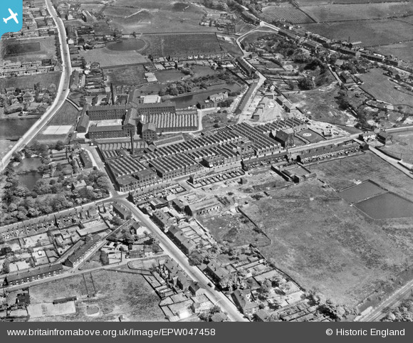
EPW047458 ENGLAND (1935). Newton Mill, Ashton Road and environs, Hyde, 1935
© Copyright OpenStreetMap contributors and licensed by the OpenStreetMap Foundation. 2026. Cartography is licensed as CC BY-SA.
Nearby Images (20)
EPW047458

EAW008507

EPW047455

EPW047454

EAW008510

EAW008504

EPW047457

EPW047452

EAW008505

EAW008508

EAW008511

EPW047456

EAW008515

EAW008506

EAW008509

EPW047453

EAW008514

EAW008512

EAW008503

EAW008513

Details
| Title | [EPW047458] Newton Mill, Ashton Road and environs, Hyde, 1935 |
| Reference | EPW047458 |
| Date | May-1935 |
| Link | |
| Place name | HYDE |
| Parish | |
| District | |
| Country | ENGLAND |
| Easting / Northing | 395267, 395989 |
| Longitude / Latitude | -2.0712930693108, 53.460373844663 |
| National Grid Reference | SJ953960 |
Pins

stardelta |
Monday 23rd of June 2014 09:35:51 PM |