
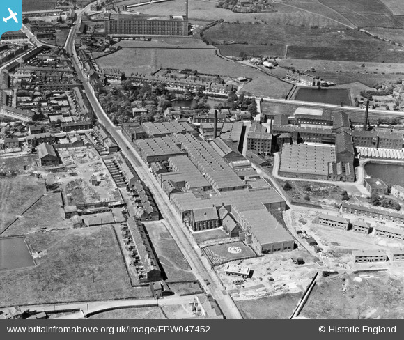
EPW047452 ENGLAND (1935). Newton Mill, Ashton Road and environs, Hyde, 1935
© Copyright OpenStreetMap contributors and licensed by the OpenStreetMap Foundation. 2026. Cartography is licensed as CC BY-SA.
Nearby Images (20)
EPW047452

EAW008505

EPW047456

EAW008515

EAW008511

EAW008506

EAW008508

EPW047454

EPW047457

EAW008510

EPW047455

EPW047458

EAW008507

EAW008504

EAW008514

EAW008512

EAW008509

EPW047453

EAW008513

EAW008503

Details
| Title | [EPW047452] Newton Mill, Ashton Road and environs, Hyde, 1935 |
| Reference | EPW047452 |
| Date | May-1935 |
| Link | |
| Place name | HYDE |
| Parish | |
| District | |
| Country | ENGLAND |
| Easting / Northing | 395283, 396035 |
| Longitude / Latitude | -2.071052752259, 53.460787505865 |
| National Grid Reference | SJ953960 |
Pins

stardelta |
Thursday 12th of June 2014 03:04:33 PM |