
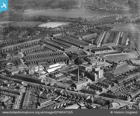
EPW047165 ENGLAND (1935). The Cape Hill Brewery and the surrounding residential area, Smethwick, 1935
© Copyright OpenStreetMap contributors and licensed by the OpenStreetMap Foundation. 2026. Cartography is licensed as CC BY-SA.
Nearby Images (10)
EPW047165

EPW047164

EPW047162

EPW047160

EPW047163

EPW047161

EPW047166

EPW047159

EPW047167

EPW047158

Details
| Title | [EPW047165] The Cape Hill Brewery and the surrounding residential area, Smethwick, 1935 |
| Reference | EPW047165 |
| Date | May-1935 |
| Link | |
| Place name | SMETHWICK |
| Parish | |
| District | |
| Country | ENGLAND |
| Easting / Northing | 403478, 287485 |
| Longitude / Latitude | -1.9487774496699, 52.48490490524 |
| National Grid Reference | SP035875 |


