
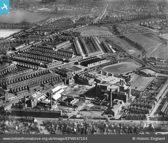
EPW047164 ENGLAND (1935). The Cape Hill Brewery and the surrounding residential area, Smethwick, 1935
© Copyright OpenStreetMap contributors and licensed by the OpenStreetMap Foundation. 2026. Cartography is licensed as CC BY-SA.
Nearby Images (10)
EPW047164

EPW047162

EPW047165

EPW047161

EPW047160

EPW047163

EPW047159

EPW047167

EPW047166

EPW047158

Details
| Title | [EPW047164] The Cape Hill Brewery and the surrounding residential area, Smethwick, 1935 |
| Reference | EPW047164 |
| Date | May-1935 |
| Link | |
| Place name | SMETHWICK |
| Parish | |
| District | |
| Country | ENGLAND |
| Easting / Northing | 403455, 287417 |
| Longitude / Latitude | -1.9491168894971, 52.484293663594 |
| National Grid Reference | SP035874 |
Pins

Bob Johnson |
Wednesday 26th of February 2014 11:34:54 PM | |
|
AndyD |
Wednesday 29th of May 2013 06:38:11 PM |
User Comment Contributions
Edgbaston Reservoir, 12/08/2015 |

Class31 |
Thursday 27th of August 2015 08:45:32 PM |