
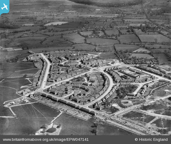
EPW047141 ENGLAND (1935). The residential area surrounding Hollington Crescent and Glebe Farm Road, Stechford, 1935
© Copyright OpenStreetMap contributors and licensed by the OpenStreetMap Foundation. 2026. Cartography is licensed as CC BY-SA.
Nearby Images (13)
EPW047141

EPW047146

EPW047143

EPW047139

EPW047145

EPW047138

EPW047142

EAW001179

EPW047144

EPW047148

EAW001175

EAW001174

EPW047147

Details
| Title | [EPW047141] The residential area surrounding Hollington Crescent and Glebe Farm Road, Stechford, 1935 |
| Reference | EPW047141 |
| Date | May-1935 |
| Link | |
| Place name | STECHFORD |
| Parish | |
| District | |
| Country | ENGLAND |
| Easting / Northing | 414168, 287919 |
| Longitude / Latitude | -1.7913217771908, 52.488634074993 |
| National Grid Reference | SP142879 |
Pins
Be the first to add a comment to this image!