
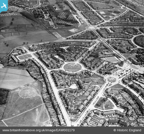
EAW001179 ENGLAND (1946). Housing estate centred upon Hollington Crescent, Glebe Farm, 1946
© Copyright OpenStreetMap contributors and licensed by the OpenStreetMap Foundation. 2026. Cartography is licensed as CC BY-SA.
Nearby Images (12)
EAW001179

EAW001174

EPW047138

EAW001175

EPW047146

EPW047141

EPW047145

EPW047139

EPW047143

EPW047144

EPW047142

EPW047147

Details
| Title | [EAW001179] Housing estate centred upon Hollington Crescent, Glebe Farm, 1946 |
| Reference | EAW001179 |
| Date | 21-June-1946 |
| Link | |
| Place name | GLEBE FARM |
| Parish | |
| District | |
| Country | ENGLAND |
| Easting / Northing | 414294, 287923 |
| Longitude / Latitude | -1.7894657850265, 52.488666751277 |
| National Grid Reference | SP143879 |
Pins

Sparky |
Sunday 24th of September 2017 12:59:11 PM |