
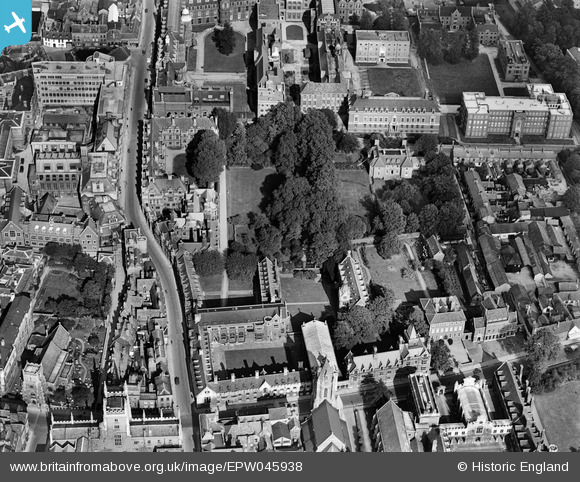
EPW045938 ENGLAND (1934). Pembroke College, Cambridge, 1934
© Copyright OpenStreetMap contributors and licensed by the OpenStreetMap Foundation. 2026. Cartography is licensed as CC BY-SA.
Nearby Images (21)
EPW045938

EPW045941

EPW045942

EPW045939

EPW045940

EPW009785

EPW000059

EPW009773

EAW014114

EPW025464

EPW000043

EPW000047

EPW000039

EAW002919

EPW000055

EAW002920

EPW009780

EPW009788

EPW009775

EAW012473

EAW002918

Details
| Title | [EPW045938] Pembroke College, Cambridge, 1934 |
| Reference | EPW045938 |
| Date | August-1934 |
| Link | |
| Place name | CAMBRIDGE |
| Parish | |
| District | |
| Country | ENGLAND |
| Easting / Northing | 544961, 258062 |
| Longitude / Latitude | 0.12142955685661, 52.201297342756 |
| National Grid Reference | TL450581 |
Pins
Be the first to add a comment to this image!