
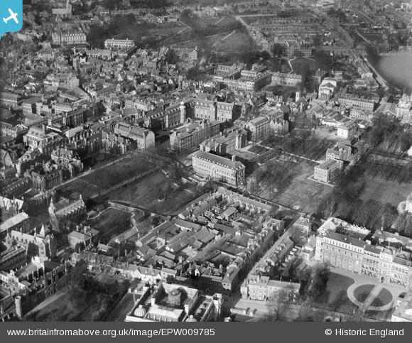
EPW009785 ENGLAND (1924). The Downing Site, Cambridge, 1924
© Copyright OpenStreetMap contributors and licensed by the OpenStreetMap Foundation. 2026. Cartography is licensed as CC BY-SA.
Nearby Images (20)
EPW009785

EPW009773

EPW025464

EPW045942

EPW045938

EPW000039

EPW009780

EPW000043

EPW045941

EPW045939

EAW014114

EPW045940

EAW002920

EPW000059

EPW000055

EPW009788

EPW000047

EPW025485

EPW009775

EAW018200

Details
| Title | [EPW009785] The Downing Site, Cambridge, 1924 |
| Reference | EPW009785 |
| Date | March-1924 |
| Link | |
| Place name | CAMBRIDGE |
| Parish | |
| District | |
| Country | ENGLAND |
| Easting / Northing | 545068, 258066 |
| Longitude / Latitude | 0.12299599593245, 52.201305132402 |
| National Grid Reference | TL451581 |
Pins
Be the first to add a comment to this image!