
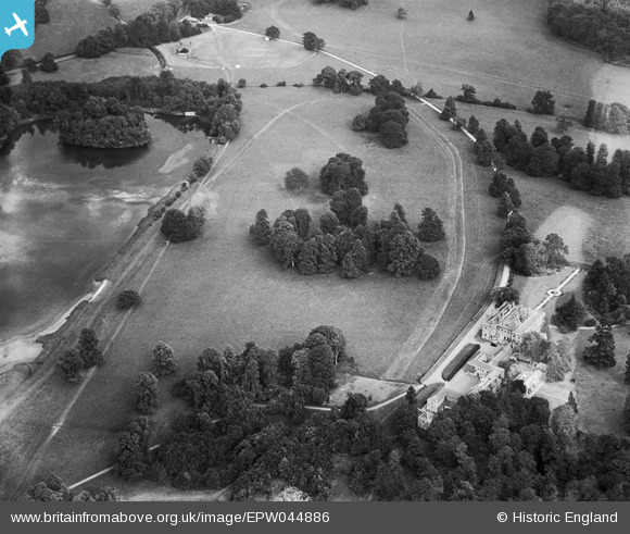
EPW044886 ENGLAND (1934). Shardeloes House and Lower Park, Amersham, 1934
© Copyright OpenStreetMap contributors and licensed by the OpenStreetMap Foundation. 2026. Cartography is licensed as CC BY-SA.
Nearby Images (18)
EPW044886

EPW044265

EPW017833

EPW021357

EPW044261

EPW021355

EPW021356

EPW044259

EPW044258

EPW044262

EPW044260

EPW044263

EPW044894

EPW021358

EPW044893

EPW044264

EPW044882

EPW044257

Details
| Title | [EPW044886] Shardeloes House and Lower Park, Amersham, 1934 |
| Reference | EPW044886 |
| Date | June-1934 |
| Link | |
| Place name | AMERSHAM |
| Parish | AMERSHAM |
| District | |
| Country | ENGLAND |
| Easting / Northing | 494000, 197902 |
| Longitude / Latitude | -0.64051231630297, 51.671552756378 |
| National Grid Reference | SU940979 |
Pins
Be the first to add a comment to this image!