
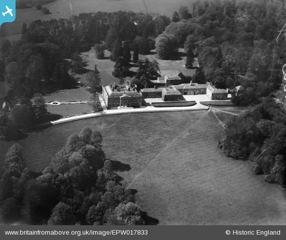
EPW017833 ENGLAND (1927). Shardeloes, Shardeloes, 1927
© Copyright OpenStreetMap contributors and licensed by the OpenStreetMap Foundation. 2026. Cartography is licensed as CC BY-SA.
Nearby Images (16)
EPW017833

EPW021357

EPW044261

EPW021356

EPW021355

EPW044258

EPW044259

EPW044262

EPW021358

EPW044260

EPW044264

EPW044263

EPW044257

EPW044265

EPW044886

EPW044894

Details
| Title | [EPW017833] Shardeloes, Shardeloes, 1927 |
| Reference | EPW017833 |
| Date | April-1927 |
| Link | |
| Place name | SHARDELOES |
| Parish | AMERSHAM |
| District | |
| Country | ENGLAND |
| Easting / Northing | 493849, 197850 |
| Longitude / Latitude | -0.64270948750333, 51.671110542325 |
| National Grid Reference | SU938979 |
Pins

totoro |
Friday 15th of November 2013 12:12:53 PM | |
|
totoro |
Friday 15th of November 2013 12:09:20 PM | |
|
totoro |
Friday 15th of November 2013 12:08:57 PM | |
|
totoro |
Friday 15th of November 2013 12:04:05 PM |
User Comment Contributions
Looking towards the South West. The small Summer House is at the back of the building, not visible in this image. |
totoro |
Friday 15th of November 2013 12:06:19 PM |