
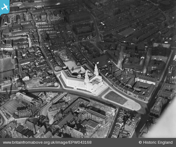
EPW043168 ENGLAND (1933). Leeds Civic Hall, Leeds, 1933
© Copyright OpenStreetMap contributors and licensed by the OpenStreetMap Foundation. 2026. Cartography is licensed as CC BY-SA.
Nearby Images (19)
EPW043168

EAW015994

EAW014661

EAW014660

EPW052168

EAW015993

EAW014658

EPW043169

EAW014659

EPW015898

EPW057199

EAW013812

EPW057200

EPW057196

EAW015998

EAW015997

EAW013813

EAW013810

EAW015738

Details
| Title | [EPW043168] Leeds Civic Hall, Leeds, 1933 |
| Reference | EPW043168 |
| Date | September-1933 |
| Link | |
| Place name | LEEDS |
| Parish | |
| District | |
| Country | ENGLAND |
| Easting / Northing | 429800, 434000 |
| Longitude / Latitude | -1.5474896589113, 53.801232400836 |
| National Grid Reference | SE298340 |
Pins
Be the first to add a comment to this image!