
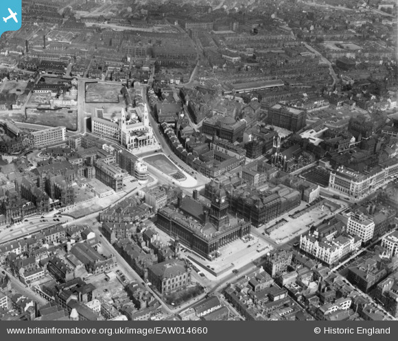
EAW014660 ENGLAND (1948). Leeds Town Hall, Civic Hall and environs, Leeds, 1948
© Copyright OpenStreetMap contributors and licensed by the OpenStreetMap Foundation. 2026. Cartography is licensed as CC BY-SA.
Nearby Images (16)
EAW014660

EAW015994

EPW043168

EAW014658

EPW052168

EAW014661

EAW014659

EPW015898

EAW015993

EPW043169

EPW057199

EAW015998

EPW057200

EAW015997

EAW015738

EAW013812

Details
| Title | [EAW014660] Leeds Town Hall, Civic Hall and environs, Leeds, 1948 |
| Reference | EAW014660 |
| Date | 21-April-1948 |
| Link | |
| Place name | LEEDS |
| Parish | |
| District | |
| Country | ENGLAND |
| Easting / Northing | 429846, 433960 |
| Longitude / Latitude | -1.5467950540685, 53.800870214422 |
| National Grid Reference | SE298340 |
Pins

redmist |
Monday 4th of October 2021 08:36:46 PM | |
Lynda Tubbs |
Tuesday 13th of May 2014 03:15:18 PM |