
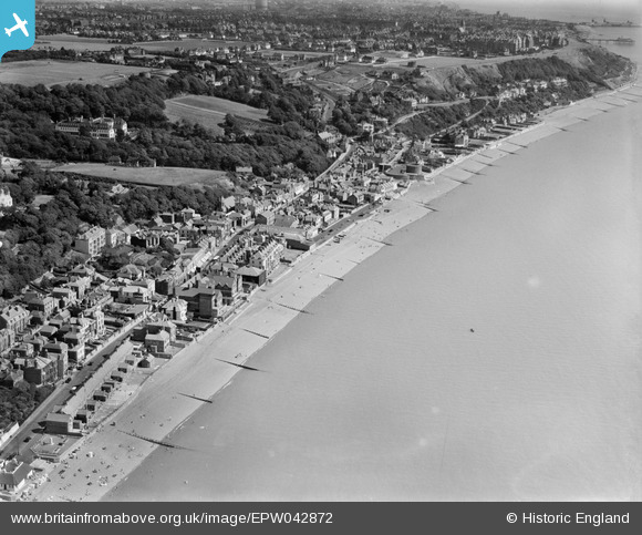
EPW042872 ENGLAND (1933). Sandgate High Street and environs, Sandgate, 1933
© Copyright OpenStreetMap contributors and licensed by the OpenStreetMap Foundation. 2026. Cartography is licensed as CC BY-SA.
Nearby Images (5)
EPW042872

EAW024822

EPW000145

EAW024824

EAW024823

Details
| Title | [EPW042872] Sandgate High Street and environs, Sandgate, 1933 |
| Reference | EPW042872 |
| Date | August-1933 |
| Link | |
| Place name | SANDGATE |
| Parish | SANDGATE |
| District | |
| Country | ENGLAND |
| Easting / Northing | 620379, 135125 |
| Longitude / Latitude | 1.1462027788877, 51.072537072912 |
| National Grid Reference | TR204351 |
Pins

flubber |
Monday 24th of March 2014 05:53:11 PM |