
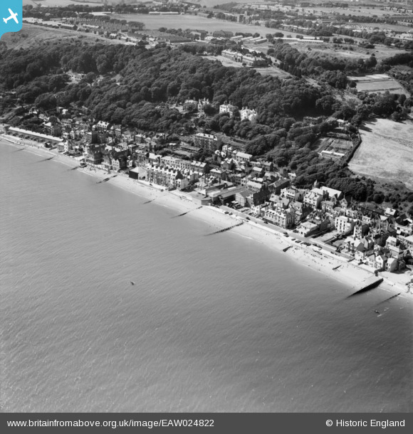
EAW024822 ENGLAND (1949). The sea front, Sandgate, 1949
© Copyright OpenStreetMap contributors and licensed by the OpenStreetMap Foundation. 2026. Cartography is licensed as CC BY-SA.
Nearby Images (5)
EAW024822

EPW042872

EPW000145

EAW024824

EAW024823

Details
| Title | [EAW024822] The sea front, Sandgate, 1949 |
| Reference | EAW024822 |
| Date | 12-July-1949 |
| Link | |
| Place name | SANDGATE |
| Parish | SANDGATE |
| District | |
| Country | ENGLAND |
| Easting / Northing | 620403, 135131 |
| Longitude / Latitude | 1.1465485149298, 51.072581734497 |
| National Grid Reference | TR204351 |
Pins

Matt Aldred edob.mattaldred.com |
Tuesday 9th of March 2021 12:05:09 PM | |
 |

Billy Turner |
Tuesday 1st of September 2020 10:21:09 PM |

Sparky |
Thursday 6th of July 2017 01:01:02 AM | |

cptpies |
Friday 17th of January 2014 09:40:04 AM |
User Comment Contributions

Type 22 Pillbox Sandgate. |
cptpies |
Friday 17th of January 2014 09:40:43 AM |