
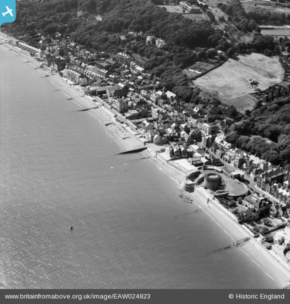
EAW024823 ENGLAND (1949). The sea front including Sandgate Fort, Sandgate, 1949
© Copyright OpenStreetMap contributors and licensed by the OpenStreetMap Foundation. 2026. Cartography is licensed as CC BY-SA.
Nearby Images (12)
EAW024823

EAW024824

EPW026119

EPW026115

EAW033165

EPW000145

EPW000649

EAW033166

EAW024822

EPW042872

EPW000146

EPW035415

Details
| Title | [EAW024823] The sea front including Sandgate Fort, Sandgate, 1949 |
| Reference | EAW024823 |
| Date | 12-July-1949 |
| Link | |
| Place name | SANDGATE |
| Parish | SANDGATE |
| District | |
| Country | ENGLAND |
| Easting / Northing | 620576, 135149 |
| Longitude / Latitude | 1.1490253104791, 51.072676905283 |
| National Grid Reference | TR206351 |
Pins

Matt Aldred edob.mattaldred.com |
Tuesday 9th of March 2021 12:02:39 PM | |
|
Matt Aldred edob.mattaldred.com |
Tuesday 9th of March 2021 12:01:12 PM | |

Paolo |
Monday 23rd of June 2014 09:14:27 PM | |
|
jrussill |
Thursday 16th of January 2014 03:56:34 PM | |
|
jrussill |
Thursday 16th of January 2014 03:51:46 PM |
User Comment Contributions

WW2 Pillbox |
jrussill |
Thursday 16th of January 2014 03:52:17 PM |