
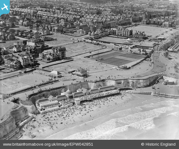
EPW042851 ENGLAND (1933). Koh-i-noor and Prince's Walk, Cliftonville, 1933
© Copyright OpenStreetMap contributors and licensed by the OpenStreetMap Foundation. 2026. Cartography is licensed as CC BY-SA.
Nearby Images (9)
EPW042851

EPW035475

EPW039330

EPW009166

EPW000287

EPW035472

EPW053802

EPW000639

EPW009235

Details
| Title | [EPW042851] Koh-i-noor and Prince's Walk, Cliftonville, 1933 |
| Reference | EPW042851 |
| Date | August-1933 |
| Link | |
| Place name | CLIFTONVILLE |
| Parish | |
| District | |
| Country | ENGLAND |
| Easting / Northing | 637222, 171386 |
| Longitude / Latitude | 1.4102275700578, 51.391342077698 |
| National Grid Reference | TR372714 |
Pins
Be the first to add a comment to this image!