
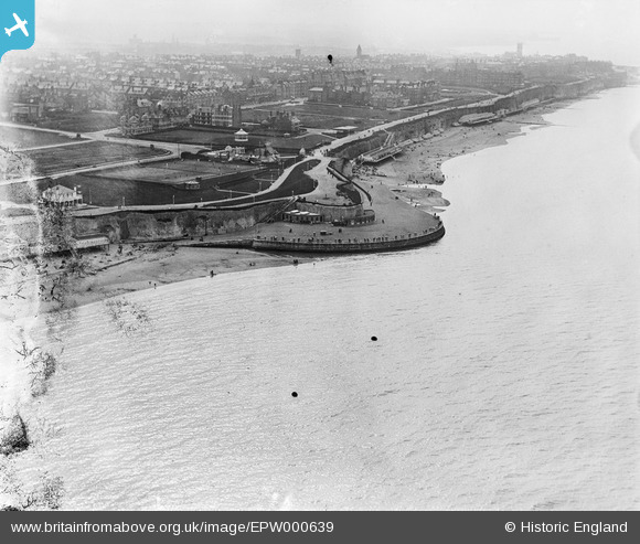
EPW000639 ENGLAND (1920). Prince's Walk, Margate, from the north-east, 1920
© Copyright OpenStreetMap contributors and licensed by the OpenStreetMap Foundation. 2026. Cartography is licensed as CC BY-SA.
Nearby Images (8)
EPW000639

EPW009235

EPW035472

EPW009166

EPW000287

EPW035475

EPW039330

EPW042851

Details
| Title | [EPW000639] Prince's Walk, Margate, from the north-east, 1920 |
| Reference | EPW000639 |
| Date | April-1920 |
| Link | |
| Place name | MARGATE |
| Parish | |
| District | |
| Country | ENGLAND |
| Easting / Northing | 637256, 171574 |
| Longitude / Latitude | 1.4108410465151, 51.393015489266 |
| National Grid Reference | TR373716 |
Pins
Be the first to add a comment to this image!