
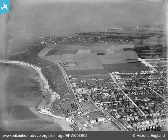
EPW053802 ENGLAND (1937). Palm Bay and the housing estate site at Northdown, Cliftonville, from the west, 1937. This image has been produced from a damaged negative.
© Copyright OpenStreetMap contributors and licensed by the OpenStreetMap Foundation. 2026. Cartography is licensed as CC BY-SA.
Nearby Images (6)
EPW053802

EPW042851

EPW035475

EPW039330

EPW000287

EPW009166

Details
| Title | [EPW053802] Palm Bay and the housing estate site at Northdown, Cliftonville, from the west, 1937. This image has been produced from a damaged negative. |
| Reference | EPW053802 |
| Date | 26-June-1937 |
| Link | |
| Place name | CLIFTONVILLE |
| Parish | |
| District | |
| Country | ENGLAND |
| Easting / Northing | 637251, 171250 |
| Longitude / Latitude | 1.410552797078, 51.390109119336 |
| National Grid Reference | TR373713 |
Pins
Be the first to add a comment to this image!