
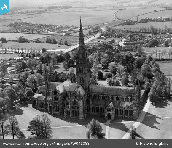
EPW041083 ENGLAND (1933). Salisbury Cathedral, Salisbury, 1933
© Copyright OpenStreetMap contributors and licensed by the OpenStreetMap Foundation. 2026. Cartography is licensed as CC BY-SA.
Nearby Images (25)
EPW041083

EPW041084

EAW051967

EAW025826

EAW051969

EAW025829
, Salisbury, 1949. This image has been produced from a damaged negative.")
EAW025832

EAW051986

EAW003563

EAW003562

EPW041080

EAW051974

EAW025828
, Salisbury, 1949. This image has been produced from a damaged negative.")
EAW051988

EPW011038

EPW011037

EAW003564

EAW025827

EAW051976

EAW025831

EAW051975

EAW051987

EAW051978

EAW051922

EAW025830

Details
| Title | [EPW041083] Salisbury Cathedral, Salisbury, 1933 |
| Reference | EPW041083 |
| Date | May-1933 |
| Link | |
| Place name | SALISBURY |
| Parish | SALISBURY |
| District | |
| Country | ENGLAND |
| Easting / Northing | 414302, 129516 |
| Longitude / Latitude | -1.7958777835927, 51.064266855249 |
| National Grid Reference | SU143295 |
Pins

Class31 |
Monday 21st of October 2013 09:58:18 PM | |
|
Class31 |
Monday 21st of October 2013 09:57:44 PM |
User Comment Contributions

Salisbury Cathedral, 16/11/2014 |
Class31 |
Sunday 20th of March 2016 12:08:56 PM |

Cathedral Church of the Blessed Virgin Mary 02/04/2014 |
Class31 |
Wednesday 2nd of April 2014 08:06:01 PM |

Cathedral Church of the Blessed Virgin Mary 02/04/2014 |
Class31 |
Wednesday 2nd of April 2014 08:04:26 PM |
View looking south. |
Class31 |
Monday 21st of October 2013 09:49:52 PM |