
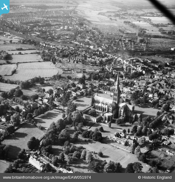
EAW051974 ENGLAND (1953). St Mary's Cathedral and environs, Salisbury, from the south-east, 1953
© Copyright OpenStreetMap contributors and licensed by the OpenStreetMap Foundation. 2026. Cartography is licensed as CC BY-SA.
Nearby Images (23)
EAW051974

EAW025829
, Salisbury, 1949. This image has been produced from a damaged negative.")
EAW003564

EAW051967

EAW003562

EPW041083

EAW025828
, Salisbury, 1949. This image has been produced from a damaged negative.")
EPW041084

EAW025831

EAW025826

EAW051969

EAW051975

EAW025827

EAW025832

EAW051986

EAW003563

EPW041080

EAW051976

EAW051988

EPW011038

EAW051987

EPW011037

EAW051978

Details
| Title | [EAW051974] St Mary's Cathedral and environs, Salisbury, from the south-east, 1953 |
| Reference | EAW051974 |
| Date | 5-September-1953 |
| Link | |
| Place name | SALISBURY |
| Parish | SALISBURY |
| District | |
| Country | ENGLAND |
| Easting / Northing | 414268, 129447 |
| Longitude / Latitude | -1.7963657604665, 51.063647176207 |
| National Grid Reference | SU143294 |
Pins

Ben |
Wednesday 5th of April 2023 02:26:34 PM | |

Lee |
Tuesday 14th of March 2017 04:38:55 AM | |
|
Lee |
Tuesday 14th of March 2017 04:37:51 AM | |
|
Lee |
Tuesday 14th of March 2017 04:29:52 AM | |
|
Lee |
Tuesday 14th of March 2017 04:29:14 AM | |
|
Lee |
Tuesday 14th of March 2017 04:27:54 AM | |
|
Lee |
Tuesday 14th of March 2017 04:25:50 AM | |
|
Lee |
Tuesday 14th of March 2017 04:23:58 AM | |
|
Lee |
Tuesday 14th of March 2017 04:21:21 AM | |
|
Lee |
Tuesday 14th of March 2017 04:20:14 AM |