
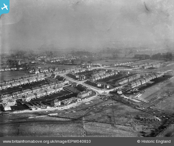
EPW040810 ENGLAND (1933). Housing estate under construction at Kings Road, Rayners Lane, from the south-west, 1933
© Copyright OpenStreetMap contributors and licensed by the OpenStreetMap Foundation. 2025. Cartography is licensed as CC BY-SA.
Nearby Images (8)
EPW040810

EPW040816

EPW040813

EPW046496

EPW040809

EPW046493

EPW040807

EPW046492

Details
| Title | [EPW040810] Housing estate under construction at Kings Road, Rayners Lane, from the south-west, 1933 |
| Reference | EPW040810 |
| Date | February-1933 |
| Link | |
| Place name | RAYNERS LANE |
| Parish | |
| District | |
| Country | ENGLAND |
| Easting / Northing | 512637, 187036 |
| Longitude / Latitude | -0.37457386177475, 51.570453544317 |
| National Grid Reference | TQ126870 |
Pins
Be the first to add a comment to this image!