
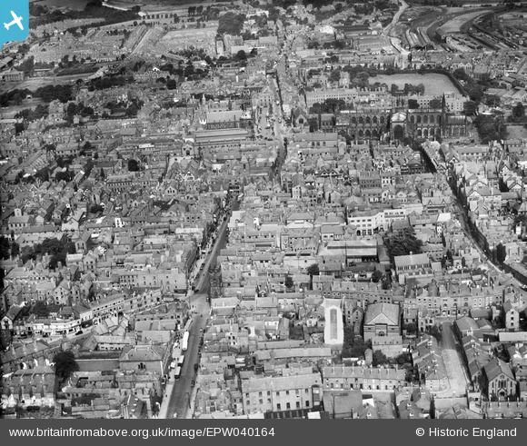
EPW040164 ENGLAND (1932). Bridge Street and the city centre, Chester, 1932
© Copyright OpenStreetMap contributors and licensed by the OpenStreetMap Foundation. 2026. Cartography is licensed as CC BY-SA.
Nearby Images (24)
EPW040164

EPW037241

EPW029884

EPW003097

EPW005884

EPW058002

EPW029885

EPW037240

EPW058010

EPW029881

EPW058009

EPW036909

EPW005883

EPW029883

EPW004008

EPW004003

EPW029886

EPW003093

EPW005885

EPW040162

EPW004006

EPW036910

EPW004007

EPW011200

Details
| Title | [EPW040164] Bridge Street and the city centre, Chester, 1932 |
| Reference | EPW040164 |
| Date | September-1932 |
| Link | |
| Place name | CHESTER |
| Parish | |
| District | |
| Country | ENGLAND |
| Easting / Northing | 340559, 366245 |
| Longitude / Latitude | -2.889719575352, 53.189682888017 |
| National Grid Reference | SJ406662 |
Pins

London1955 |
Saturday 13th of July 2013 12:16:13 PM | |
|
London1955 |
Saturday 13th of July 2013 12:14:43 PM | |
|
London1955 |
Saturday 13th of July 2013 12:13:41 PM | |
|
London1955 |
Saturday 13th of July 2013 12:12:30 PM | |
|
London1955 |
Saturday 13th of July 2013 12:10:10 PM | |
|
London1955 |
Saturday 13th of July 2013 12:09:35 PM | |
|
London1955 |
Saturday 13th of July 2013 12:09:15 PM |