
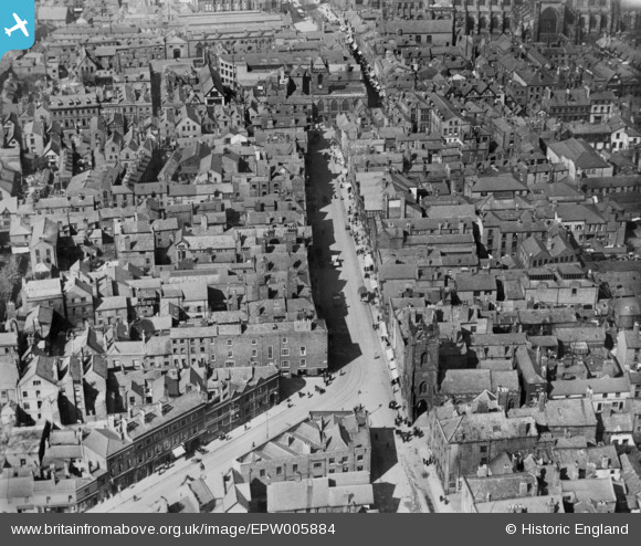
EPW005884 ENGLAND (1921). Bridge Street, Chester, 1921. This image has been produced from a copy-negative.
© Copyright OpenStreetMap contributors and licensed by the OpenStreetMap Foundation. 2026. Cartography is licensed as CC BY-SA.
Nearby Images (20)
EPW005884

EPW037241

EPW040164

EPW036909

EPW005883

EPW029884

EPW058009

EPW003097

EPW037240

EPW058002

EPW029885

EPW058010

EPW029881

EPW003093

EPW036910

EPW029883

EAW013772

EPW058003

EPW058008

EPW003088

Details
| Title | [EPW005884] Bridge Street, Chester, 1921. This image has been produced from a copy-negative. |
| Reference | EPW005884 |
| Date | March-1921 |
| Link | |
| Place name | CHESTER |
| Parish | |
| District | |
| Country | ENGLAND |
| Easting / Northing | 340540, 366165 |
| Longitude / Latitude | -2.8899890409709, 53.188961656554 |
| National Grid Reference | SJ405662 |
Pins


User Comment Contributions

Bridge Street, Chester, 18/07/2015 |

Class31 |
Friday 7th of August 2015 08:07:15 AM |