
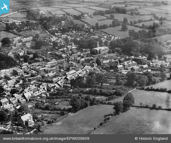
EPW039809 ENGLAND (1932). St Petrock's Church and the town centre, Bodmin, 1932
© Copyright OpenStreetMap contributors and licensed by the OpenStreetMap Foundation. 2026. Cartography is licensed as CC BY-SA.
Nearby Images (7)
EPW039809

EPW039804

EPW021681

EPW039806

EPW021680

EPW021684

EPW021679

Details
| Title | [EPW039809] St Petrock's Church and the town centre, Bodmin, 1932 |
| Reference | EPW039809 |
| Date | August-1932 |
| Link | |
| Place name | BODMIN |
| Parish | BODMIN |
| District | |
| Country | ENGLAND |
| Easting / Northing | 207134, 67002 |
| Longitude / Latitude | -4.718204932429, 50.470470834031 |
| National Grid Reference | SX071670 |
Pins

CornwallPhil |
Thursday 3rd of July 2014 07:31:36 PM |