
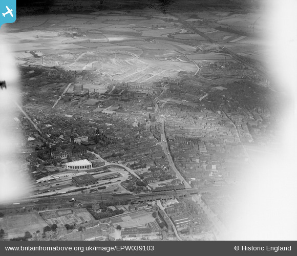
EPW039103 ENGLAND (1932). Westgate Railway Station, Westgate and the city centre, Wakefield, 1932
© Copyright OpenStreetMap contributors and licensed by the OpenStreetMap Foundation. 2026. Cartography is licensed as CC BY-SA.
Nearby Images (18)
EPW039103

EPW016289

EPW039104

EPW016285

EAW015510

EPW016287

EAW025172

EPW039105

EAW015515

EPW039106

EAW015513

EAW015511

EPW061508

EAW015516

EAW015514

EAW015512

EAW025171

EAW025174

Details
| Title | [EPW039103] Westgate Railway Station, Westgate and the city centre, Wakefield, 1932 |
| Reference | EPW039103 |
| Date | July-1932 |
| Link | |
| Place name | WAKEFIELD |
| Parish | |
| District | |
| Country | ENGLAND |
| Easting / Northing | 433278, 420859 |
| Longitude / Latitude | -1.4960937873038, 53.682900380285 |
| National Grid Reference | SE333209 |
