
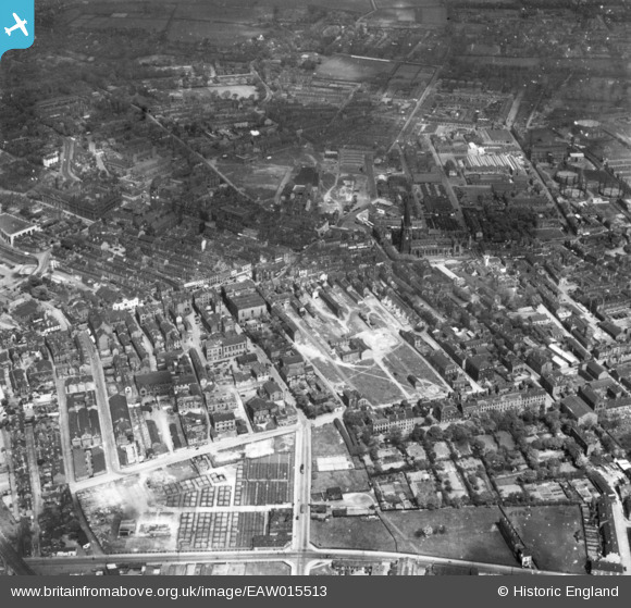
EAW015513 ENGLAND (1948). The city centre, Wakefield, 1948. This image has been produced from a print.
© Copyright OpenStreetMap contributors and licensed by the OpenStreetMap Foundation. 2026. Cartography is licensed as CC BY-SA.
Nearby Images (17)
EAW015513

EPW039105

EAW015515

EAW015516

EPW039106

EAW025172

EAW015514

EPW039104

EPW039103

EPW016289

EAW025171

EPW016287

EPW016285

EPW061508

EAW015510

EAW015512

EAW015511

Details
| Title | [EAW015513] The city centre, Wakefield, 1948. This image has been produced from a print. |
| Reference | EAW015513 |
| Date | 14-May-1948 |
| Link | |
| Place name | WAKEFIELD |
| Parish | |
| District | |
| Country | ENGLAND |
| Easting / Northing | 433188, 420742 |
| Longitude / Latitude | -1.4974690587506, 53.681854411199 |
| National Grid Reference | SE332207 |
Pins
Be the first to add a comment to this image!