
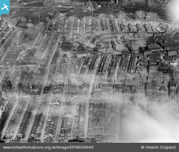
EPW036849 ENGLAND (1931). Hope Streetand environs, Halifax, 1931
© Copyright OpenStreetMap contributors and licensed by the OpenStreetMap Foundation. 2026. Cartography is licensed as CC BY-SA.
Nearby Images (15)
EPW036849

EAW028056

EPW036846

EAW030678

EAW030674

EAW030677

EAW030680

EAW030675

EAW030676

EAW030679

EAW030673

EAW030681

EPW036847

EPW024494

EAW028053

Details
| Title | [EPW036849] Hope Streetand environs, Halifax, 1931 |
| Reference | EPW036849 |
| Date | September-1931 |
| Link | |
| Place name | HALIFAX |
| Parish | |
| District | |
| Country | ENGLAND |
| Easting / Northing | 408709, 425346 |
| Longitude / Latitude | -1.8679967343541, 53.724221950926 |
| National Grid Reference | SE087253 |
Pins
Be the first to add a comment to this image!