
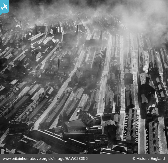
EAW028056 ENGLAND (1950). Rhodes Street and environs, Halifax, 1950
© Copyright OpenStreetMap contributors and licensed by the OpenStreetMap Foundation. 2026. Cartography is licensed as CC BY-SA.
Nearby Images (14)
EAW028056

EPW036846

EPW036849

EAW030678

EPW036847

EPW024494

EAW030674

EAW030680

EAW030677

EAW030675

EAW030676

EAW030679

EAW030673

EAW030681

Details
| Title | [EAW028056] Rhodes Street and environs, Halifax, 1950 |
| Reference | EAW028056 |
| Date | 21-February-1950 |
| Link | |
| Place name | HALIFAX |
| Parish | |
| District | |
| Country | ENGLAND |
| Easting / Northing | 408692, 425296 |
| Longitude / Latitude | -1.8682558092963, 53.723772779454 |
| National Grid Reference | SE087253 |
Pins
Be the first to add a comment to this image!