
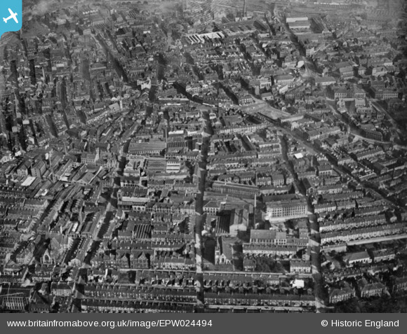
EPW024494 ENGLAND (1928). Lister Lane and the town, Halifax, from the west, 1928. This image has been produced from a copy-negative.
© Copyright OpenStreetMap contributors and licensed by the OpenStreetMap Foundation. 2026. Cartography is licensed as CC BY-SA.
Nearby Images (15)
EPW024494

EPW036846

EPW036847

EAW028056

EPW036849

EPW013882

EAW030678

EAW030680

EAW030674

EAW030675

EAW030677

EAW030681

EAW030679

EAW030673

EPW013880

Details
| Title | [EPW024494] Lister Lane and the town, Halifax, from the west, 1928. This image has been produced from a copy-negative. |
| Reference | EPW024494 |
| Date | September-1928 |
| Link | |
| Place name | HALIFAX |
| Parish | |
| District | |
| Country | ENGLAND |
| Easting / Northing | 408713, 425126 |
| Longitude / Latitude | -1.8679423020075, 53.722244281786 |
| National Grid Reference | SE087251 |
