
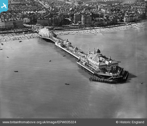
EPW035324 ENGLAND (1931). The pier, Eastbourne, 1931
© Copyright OpenStreetMap contributors and licensed by the OpenStreetMap Foundation. 2026. Cartography is licensed as CC BY-SA.
Nearby Images (13)
EPW035324

EPW000067

EPW000746

EAW006146

EAW022970

EPW035322

EPW000103

EAW022967

EPW039403

EPW000099

EPW000743

EPW000742

EPW039415

Details
| Title | [EPW035324] The pier, Eastbourne, 1931 |
| Reference | EPW035324 |
| Date | 25-May-1931 |
| Link | |
| Place name | EASTBOURNE |
| Parish | |
| District | |
| Country | ENGLAND |
| Easting / Northing | 561869, 98817 |
| Longitude / Latitude | 0.29562990576986, 50.765762031195 |
| National Grid Reference | TV619988 |
Pins

Alan McFaden |
Monday 15th of July 2013 09:40:45 AM | |
|
Alan McFaden |
Monday 15th of July 2013 09:37:58 AM | |
|
Alan McFaden |
Monday 15th of July 2013 09:37:29 AM | |
|
Alan McFaden |
Monday 15th of July 2013 09:36:47 AM |


