
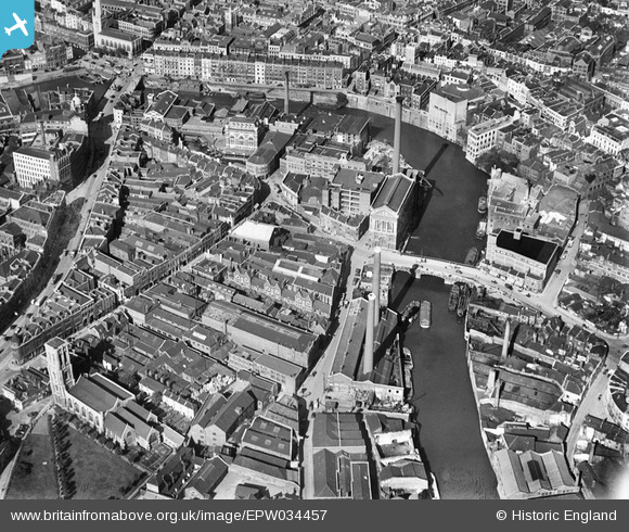
EPW034457 ENGLAND (1930). St Philip's Bridge, Works off Bath Street and environs, Bristol, 1930
© Copyright OpenStreetMap contributors and licensed by the OpenStreetMap Foundation. 2026. Cartography is licensed as CC BY-SA.
Nearby Images (27)
EPW034457

EPW034453

EPW034459
 and the Tramway Generating Station, Bristol, 1930")
EPW034454
 and the Tramway Generating Station, Bristol, 1930")
EPW034458

EPW034460
 and the Tramway Generating Station, Bristol, 1930")
EPW034452

EPW034455

EPW038301

EPW038302

EPW034451

EPW034450

EAW032256

EPW038304

EPW034456

EAW032257

EPW038300

EPW038303

EAW032259

EAW032254

EAW032258

EAW032255

EPW060117

EAW032260

EAW032261

EPW033505

EPW008821

Details
| Title | [EPW034457] St Philip's Bridge, Works off Bath Street and environs, Bristol, 1930 |
| Reference | EPW034457 |
| Date | August-1930 |
| Link | |
| Place name | BRISTOL |
| Parish | |
| District | |
| Country | ENGLAND |
| Easting / Northing | 359264, 172891 |
| Longitude / Latitude | -2.5863226379115, 51.453045178054 |
| National Grid Reference | ST593729 |
Pins

derek2847 |
Monday 5th of February 2018 07:02:05 PM | |
|
derek2847 |
Monday 5th of February 2018 06:59:58 PM | |
|
derek2847 |
Monday 5th of February 2018 06:57:55 PM | |
|
MB |
Monday 29th of August 2016 10:12:05 PM | |
Later run by Hovis Ltd |
MB |
Monday 29th of August 2016 10:12:33 PM |
|
MB |
Monday 29th of August 2016 10:09:35 PM | |
|
kent2 |
Saturday 20th of July 2013 07:08:01 AM | |
|
kent2 |
Saturday 20th of July 2013 07:06:45 AM | |
|
kent2 |
Saturday 20th of July 2013 07:05:19 AM | |
|
kent2 |
Saturday 20th of July 2013 07:04:29 AM | |
The church was gutted in Second World War air raids. The tower still stands |
MB |
Monday 29th of August 2016 10:10:40 PM |

Class31 |
Monday 10th of June 2013 09:11:34 PM | |
|
Class31 |
Wednesday 6th of February 2013 03:55:10 PM | |
|
Class31 |
Wednesday 6th of February 2013 03:51:36 PM | |
|
Class31 |
Wednesday 6th of February 2013 03:48:49 PM | |
|
Class31 |
Wednesday 6th of February 2013 03:46:02 PM | |
|
Class31 |
Wednesday 6th of February 2013 03:42:16 PM |
