
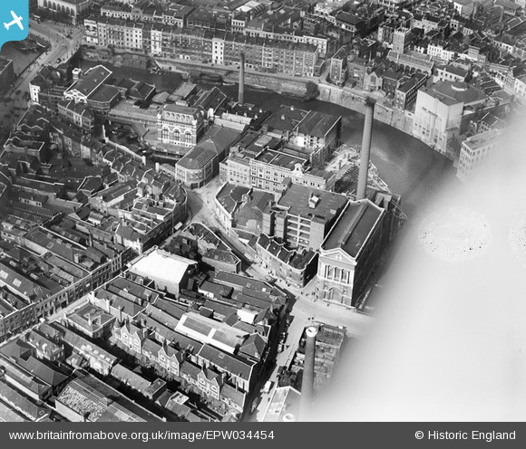
EPW034454 ENGLAND (1930). George's Brewery, Bennett's Counterslip Works (Print and Stationey) and the Tramway Generating Station, Bristol, 1930
© Copyright OpenStreetMap contributors and licensed by the OpenStreetMap Foundation. 2026. Cartography is licensed as CC BY-SA.
Nearby Images (27)
EPW034454
 and the Tramway Generating Station, Bristol, 1930")
EPW034459
 and the Tramway Generating Station, Bristol, 1930")
EPW034453

EPW034460
 and the Tramway Generating Station, Bristol, 1930")
EPW034458

EPW034457

EPW034452

EPW038301

EPW038302

EPW034451

EPW034455

EPW034450

EPW038304

EPW034456

EPW038300

EPW038303

EAW032256

EAW032257

EPW060117

EAW032259

EAW032254

EAW032258

EPW033498

EAW032255

EAW032260

EAW032261

EPW033505

Details
| Title | [EPW034454] George's Brewery, Bennett's Counterslip Works (Print and Stationey) and the Tramway Generating Station, Bristol, 1930 |
| Reference | EPW034454 |
| Date | August-1930 |
| Link | |
| Place name | BRISTOL |
| Parish | |
| District | |
| Country | ENGLAND |
| Easting / Northing | 359228, 172927 |
| Longitude / Latitude | -2.5868449156342, 51.453366301833 |
| National Grid Reference | ST592729 |
Pins

Class31 |
Wednesday 6th of February 2013 03:35:00 PM | |
|
Class31 |
Wednesday 6th of February 2013 03:33:47 PM | |
|
Class31 |
Wednesday 6th of February 2013 03:32:58 PM | |
|
Class31 |
Wednesday 6th of February 2013 03:32:44 PM | |
|
Class31 |
Wednesday 6th of February 2013 03:30:52 PM | |
|
Class31 |
Wednesday 6th of February 2013 03:30:21 PM | |
|
Class31 |
Wednesday 6th of February 2013 03:30:03 PM | |
|
Class31 |
Wednesday 6th of February 2013 03:29:41 PM |