
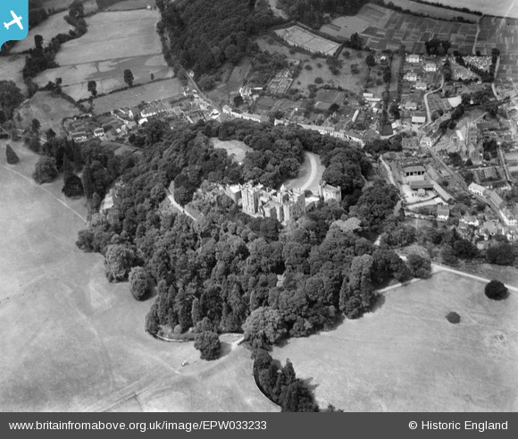
EPW033233 ENGLAND (1930). Dunster Castle and environs, Dunster, 1930
© Copyright OpenStreetMap contributors and licensed by the OpenStreetMap Foundation. 2026. Cartography is licensed as CC BY-SA.
Nearby Images (16)
EPW033233

EAW015008

EAW015006

EAW005863

EAW005861

EAW015010

EAW005864

EAW005860

EAW005862

EAW015007

EPW033231

EAW015009

EPW033234

EPW033723

EPW033721

EPW033722

Details
| Title | [EPW033233] Dunster Castle and environs, Dunster, 1930 |
| Reference | EPW033233 |
| Date | July-1930 |
| Link | |
| Place name | DUNSTER |
| Parish | DUNSTER |
| District | |
| Country | ENGLAND |
| Easting / Northing | 299192, 143473 |
| Longitude / Latitude | -3.4424252131291, 51.181069663055 |
| National Grid Reference | SS992435 |
Pins
Be the first to add a comment to this image!