
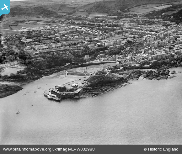
EPW032988 ENGLAND (1930). Lantern Hill, the harbour and the town, Ilfracombe, 1930
© Copyright OpenStreetMap contributors and licensed by the OpenStreetMap Foundation. 2026. Cartography is licensed as CC BY-SA.
Nearby Images (8)
EPW032988

EPW000959

EPW032983

EPW000971

EPW039947

EPW039946

EPW000955

EPW000960

Details
| Title | [EPW032988] Lantern Hill, the harbour and the town, Ilfracombe, 1930 |
| Reference | EPW032988 |
| Date | July-1930 |
| Link | |
| Place name | ILFRACOMBE |
| Parish | ILFRACOMBE |
| District | |
| Country | ENGLAND |
| Easting / Northing | 252465, 147805 |
| Longitude / Latitude | -4.1123955850201, 51.209851492433 |
| National Grid Reference | SS525478 |
Pins

Louis |
Wednesday 26th of December 2012 04:12:38 PM | |
I tend to think this is actually "Devonia", manly because she had 13 square ports towards the stern, as here, whereas the only picture I have so far located of "Glen Gower" suggst she had round ports there. |
mannidaze |
Wednesday 9th of January 2013 09:58:36 PM |