
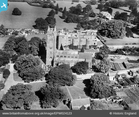
EPW024123 ENGLAND (1928). St Mary's Church and Thornbury Castle, Thornbury, 1928
© Copyright OpenStreetMap contributors and licensed by the OpenStreetMap Foundation. 2026. Cartography is licensed as CC BY-SA.
Nearby Images (9)
EPW024123

EAW006839

EAW006840

EAW006836

EAW006841

EAW006838

EAW006835

EPW024122

EAW006837

Details
| Title | [EPW024123] St Mary's Church and Thornbury Castle, Thornbury, 1928 |
| Reference | EPW024123 |
| Date | September-1928 |
| Link | |
| Place name | THORNBURY |
| Parish | THORNBURY |
| District | |
| Country | ENGLAND |
| Easting / Northing | 363410, 190614 |
| Longitude / Latitude | -2.5284934262273, 51.612694924283 |
| National Grid Reference | ST634906 |
Pins
Be the first to add a comment to this image!
User Comment Contributions
Thornbury Castle |

Robert - Cumbria |
Wednesday 27th of June 2012 06:33:09 PM |