
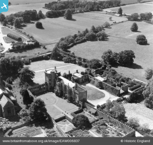
EAW006837 ENGLAND (1947). Thornbury Castle, Thornbury, 1947. This image has been produced from a print.
© Copyright OpenStreetMap contributors and licensed by the OpenStreetMap Foundation. 2026. Cartography is licensed as CC BY-SA.
Nearby Images (9)
EAW006837

EPW024122

EAW006835

EAW006836

EAW006840

EAW006838

EAW006841

EAW006839

EPW024123

Details
| Title | [EAW006837] Thornbury Castle, Thornbury, 1947. This image has been produced from a print. |
| Reference | EAW006837 |
| Date | 10-June-1947 |
| Link | |
| Place name | THORNBURY |
| Parish | THORNBURY |
| District | |
| Country | ENGLAND |
| Easting / Northing | 363336, 190705 |
| Longitude / Latitude | -2.5295717299798, 51.613508375746 |
| National Grid Reference | ST633907 |
Pins
Be the first to add a comment to this image!