
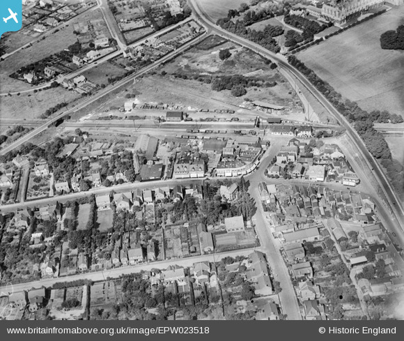
EPW023518 ENGLAND (1928). Ashford Railway Station and environs, Ashford, 1928
© Copyright OpenStreetMap contributors and licensed by the OpenStreetMap Foundation. 2026. Cartography is licensed as CC BY-SA.
Nearby Images (6)
EPW023518

EPW023522

EPW028355

EPW028357

EPW023517

EPW023520

Details
| Title | [EPW023518] Ashford Railway Station and environs, Ashford, 1928 |
| Reference | EPW023518 |
| Date | September-1928 |
| Link | |
| Place name | ASHFORD |
| Parish | |
| District | |
| Country | ENGLAND |
| Easting / Northing | 506537, 171878 |
| Longitude / Latitude | -0.46714529596008, 51.435380082137 |
| National Grid Reference | TQ065719 |
Pins

JOHNAA |
Tuesday 19th of November 2013 08:00:02 PM | |
|
JOHNAA |
Tuesday 19th of November 2013 07:56:19 PM | |
|
JOHNAA |
Tuesday 19th of November 2013 07:55:05 PM | |
|
Neil Smith |
Wednesday 11th of September 2013 04:56:06 PM | |
|
librarian |
Tuesday 11th of December 2012 01:07:54 PM | |
|
librarian |
Tuesday 11th of December 2012 01:07:31 PM | |
|
librarian |
Tuesday 11th of December 2012 01:07:08 PM | |
|
librarian |
Tuesday 11th of December 2012 01:06:33 PM |
User Comment Contributions
This is Ashford, Middlesex (as opposed to Kent). Top right of photo is St James School, which was previously St. David's School for Girls, and prior to that it was called The Welsh Girls School. |
librarian |
Tuesday 11th of December 2012 01:03:26 PM |