
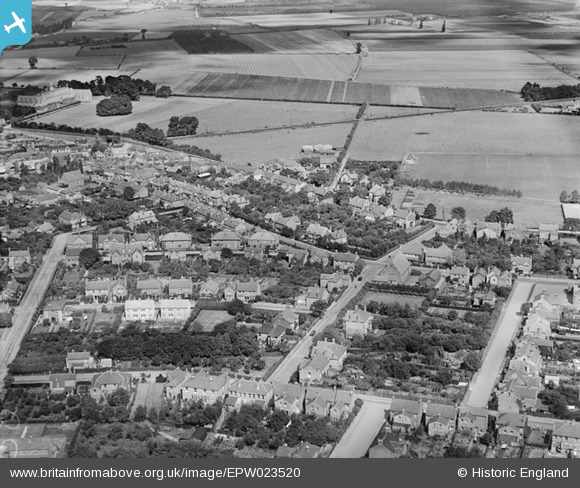
EPW023520 ENGLAND (1928). Dudley Road and environs, Ashford, 1928
© Copyright OpenStreetMap contributors and licensed by the OpenStreetMap Foundation. 2026. Cartography is licensed as CC BY-SA.
Nearby Images (7)
EPW023520

EPW023517

EPW028356

EPR000460

EPW023522

EPW023518

EPW028355

Details
| Title | [EPW023520] Dudley Road and environs, Ashford, 1928 |
| Reference | EPW023520 |
| Date | September-1928 |
| Link | |
| Place name | ASHFORD |
| Parish | |
| District | |
| Country | ENGLAND |
| Easting / Northing | 506719, 171657 |
| Longitude / Latitude | -0.46459430512561, 51.433359168418 |
| National Grid Reference | TQ067717 |
Pins

Captain MC |
Sunday 8th of December 2013 05:02:08 PM | |
|
JOHNAA |
Friday 6th of December 2013 10:24:25 PM | |
|
JOHNAA |
Friday 6th of December 2013 10:23:44 PM | |
|
JOHNAA |
Friday 6th of December 2013 10:22:46 PM | |
|
librarian |
Saturday 14th of July 2012 06:56:48 PM | |
It is actually St David's Senior Boys School. |
JOHNAA |
Thursday 5th of December 2013 06:29:09 PM |
It's now St James' senior boys school |
Dansan |
Friday 25th of July 2014 11:16:07 AM |