
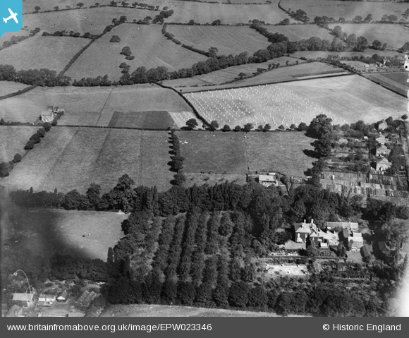
EPW023346 ENGLAND (1928). Farmland, Haslington, 1928
© Copyright OpenStreetMap contributors and licensed by the OpenStreetMap Foundation. 2026. Cartography is licensed as CC BY-SA.
Nearby Images (11)
EPW023346

EPW022264

EPW022265

EPW022263

EPW023343

EPW022266

EPW022269

EPW023345

EPW023344

EPW022268

EPW022262

Details
| Title | [EPW023346] Farmland, Haslington, 1928 |
| Reference | EPW023346 |
| Date | September-1928 |
| Link | |
| Place name | HASLINGTON |
| Parish | HASLINGTON |
| District | |
| Country | ENGLAND |
| Easting / Northing | 373303, 356022 |
| Longitude / Latitude | -2.398772535809, 53.100432152109 |
| National Grid Reference | SJ733560 |
Pins
User Comment Contributions
Thanks for the identification! We'll update the catalogue and post the new data here in due course. Yours, Katy Britain from Above Cataloguing Team Leader |
Katy Whitaker |
Wednesday 8th of January 2014 09:16:54 AM |
View is looking north |

Class31 |
Friday 29th of November 2013 10:12:50 PM |
View is looking north |
Class31 |
Friday 29th of November 2013 10:10:41 PM |
Eureka Haslington in Cheshire. See EPW022268 for some information which is identical. |
Class31 |
Friday 29th of November 2013 09:42:58 PM |
I agree about sequence of photos EPW023343- EPW023346. I think photos taken about midday, this one from the west. |

BigglesH |
Tuesday 31st of July 2012 05:05:30 AM |
This photo appears to be one of a sequence EPW023343-EPW023346. The cornfield appears to be the same in each shot. |
Class31 |
Monday 23rd of July 2012 09:44:57 AM |