
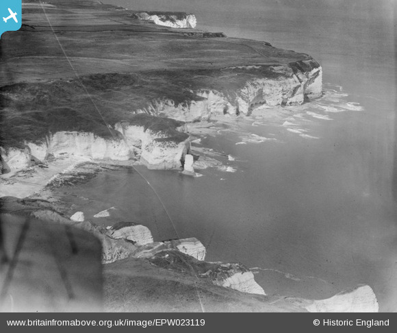
EPW023119 ENGLAND (1928). Selwicks Bay and Molk Hole, Flamborough Head, 1928
© Copyright OpenStreetMap contributors and licensed by the OpenStreetMap Foundation. 2026. Cartography is licensed as CC BY-SA.
Nearby Images (8)
EPW023119

EAW013988

EPW023116

EPW039056

EPW023117

EPW023115

EAW013986

EPW039055

Details
| Title | [EPW023119] Selwicks Bay and Molk Hole, Flamborough Head, 1928 |
| Reference | EPW023119 |
| Date | August-1928 |
| Link | |
| Place name | FLAMBOROUGH HEAD |
| Parish | FLAMBOROUGH |
| District | |
| Country | ENGLAND |
| Easting / Northing | 525498, 470939 |
| Longitude / Latitude | -0.079679463163409, 54.118802923143 |
| National Grid Reference | TA255709 |
Pins
Be the first to add a comment to this image!