
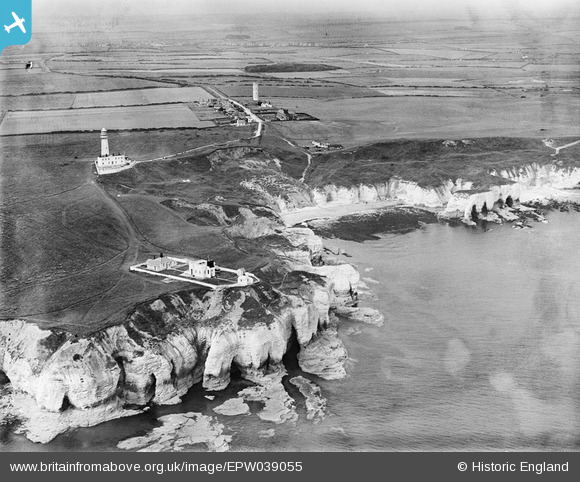
EPW039055 ENGLAND (1932). The chalk cliffs, fog station and lighthouses, Flamborough Head, from the east, 932
© Copyright OpenStreetMap contributors and licensed by the OpenStreetMap Foundation. 2026. Cartography is licensed as CC BY-SA.
Nearby Images (7)
EPW039055

EPW023115

EPW039056

EPW023116

EAW013990

EAW013987

EPW023119

Details
| Title | [EPW039055] The chalk cliffs, fog station and lighthouses, Flamborough Head, from the east, 932 |
| Reference | EPW039055 |
| Date | July-1932 |
| Link | |
| Place name | FLAMBOROUGH HEAD |
| Parish | FLAMBOROUGH |
| District | |
| Country | ENGLAND |
| Easting / Northing | 525740, 470768 |
| Longitude / Latitude | -0.076049950572568, 54.117207635532 |
| National Grid Reference | TA257708 |
Pins
Be the first to add a comment to this image!