
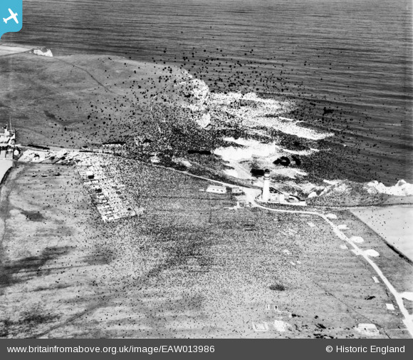
EAW013986 ENGLAND (1948). Selwick Drive, Flamborough Lighthouse and environs, Flamborough Head, 1948. This image has been produced from a damaged negative.
© Copyright OpenStreetMap contributors and licensed by the OpenStreetMap Foundation. 2026. Cartography is licensed as CC BY-SA.
Nearby Images (7)
EAW013986

EPW023117

EAW013988

EPW023118

EPW023116

EAW013987

EPW023119

Details
| Title | [EAW013986] Selwick Drive, Flamborough Lighthouse and environs, Flamborough Head, 1948. This image has been produced from a damaged negative. |
| Reference | EAW013986 |
| Date | 23-March-1948 |
| Link | |
| Place name | FLAMBOROUGH HEAD |
| Parish | FLAMBOROUGH |
| District | |
| Country | ENGLAND |
| Easting / Northing | 525381, 470713 |
| Longitude / Latitude | -0.08156243415059, 54.116801194126 |
| National Grid Reference | TA254707 |
Pins

redmist |
Wednesday 13th of November 2019 02:29:56 PM | |
These are also temporary gun pits with pile platforms for 3.7in anti-aircraft guns. Both BJ and BJ1 batteries, which comprised the Flamborough Diver Fringe battery, consisted of four 3.7 in anti-aircraft guns.The documentary evidence shows no LAA guns on this site. |
Chris Kolonko |
Thursday 27th of February 2020 12:02:51 PM |
|
Mark P |
Friday 27th of September 2019 09:29:14 PM |