
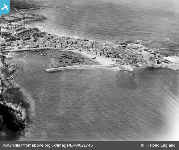
EPW021745 ENGLAND (1928). The harbour and the town, St Ives, 1928
© Copyright OpenStreetMap contributors and licensed by the OpenStreetMap Foundation. 2025. Cartography is licensed as CC BY-SA.
Nearby Images (10)
EPW021745

EPW021747

EPW059855

EPW021752

EPW039835

EAW257342

EPW039834

EPW021748

EPW021744

EPW039833

Details
| Title | [EPW021745] The harbour and the town, St Ives, 1928 |
| Reference | EPW021745 |
| Date | 24-June-1928 |
| Link | |
| Place name | ST IVES |
| Parish | ST. IVES |
| District | |
| Country | ENGLAND |
| Easting / Northing | 152082, 40719 |
| Longitude / Latitude | -5.4754539901325, 50.213824262793 |
| National Grid Reference | SW521407 |
Pins
Be the first to add a comment to this image!