
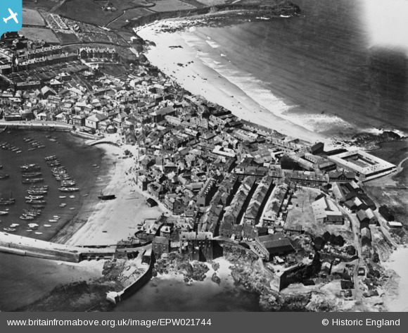
EPW021744 ENGLAND (1928). Porthmeor Beach and the town, St Ives, 1928. This image has been produced from a copy-negative.
© Copyright OpenStreetMap contributors and licensed by the OpenStreetMap Foundation. 2025. Cartography is licensed as CC BY-SA.
Nearby Images (11)
EPW021744

EAW257342

EPW021752

EPW059854

EPW021748

EPW021747

EPW039834

EPW039835

EPW021745

EPW059855

EAW004888

Details
| Title | [EPW021744] Porthmeor Beach and the town, St Ives, 1928. This image has been produced from a copy-negative. |
| Reference | EPW021744 |
| Date | 24-June-1928 |
| Link | |
| Place name | ST IVES |
| Parish | ST. IVES |
| District | |
| Country | ENGLAND |
| Easting / Northing | 151940, 40870 |
| Longitude / Latitude | -5.4775393946844, 50.215120413201 |
| National Grid Reference | SW519409 |
Pins
Be the first to add a comment to this image!