
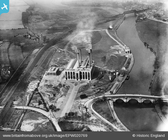
EPW020769 ENGLAND (1928). Ferrybridge Power Station and Ferry Bridge, Ferrybridge, 1928
© Copyright OpenStreetMap contributors and licensed by the OpenStreetMap Foundation. 2026. Cartography is licensed as CC BY-SA.
Nearby Images (5)
EPW020769

EPW015441

EPW018208

EPW018209

EPW020768

Details
| Title | [EPW020769] Ferrybridge Power Station and Ferry Bridge, Ferrybridge, 1928 |
| Reference | EPW020769 |
| Date | 11-April-1928 |
| Link | |
| Place name | FERRYBRIDGE |
| Parish | |
| District | |
| Country | ENGLAND |
| Easting / Northing | 448196, 424710 |
| Longitude / Latitude | -1.2696186114099, 53.716351577052 |
| National Grid Reference | SE482247 |
Pins

Derekdye |
Wednesday 23rd of January 2013 07:09:39 PM | |
|
Derekdye |
Wednesday 23rd of January 2013 07:07:12 PM | |
|
Derekdye |
Sunday 13th of January 2013 01:33:18 PM | |
|
Derekdye |
Sunday 13th of January 2013 01:29:08 PM | |

JohnM |
Thursday 4th of October 2012 08:23:56 PM | |
|
MB |
Saturday 29th of September 2012 10:05:44 AM | |
|
MB |
Saturday 29th of September 2012 10:05:10 AM | |
|
MB |
Saturday 29th of September 2012 10:04:50 AM | |
|
MB |
Saturday 29th of September 2012 10:04:11 AM | |
|
MB |
Saturday 29th of September 2012 10:03:03 AM | |
|
MB |
Saturday 29th of September 2012 10:02:07 AM | |
|
MB |
Saturday 29th of September 2012 10:01:35 AM | |
|
MB |
Saturday 29th of September 2012 10:01:10 AM | |

Class31 |
Friday 28th of September 2012 11:24:00 PM |
