
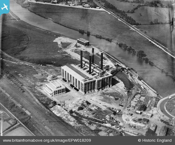
EPW018209 ENGLAND (1927). The Ferrybridge A power station, Ferrybridge, 1927
© Copyright OpenStreetMap contributors and licensed by the OpenStreetMap Foundation. 2026. Cartography is licensed as CC BY-SA.
Nearby Images (5)
EPW018209

EPW015441

EPW020769

EPW020768

EPW018208

Details
| Title | [EPW018209] The Ferrybridge A power station, Ferrybridge, 1927 |
| Reference | EPW018209 |
| Date | June-1927 |
| Link | |
| Place name | FERRYBRIDGE |
| Parish | |
| District | |
| Country | ENGLAND |
| Easting / Northing | 448194, 424735 |
| Longitude / Latitude | -1.2696450246902, 53.716576471902 |
| National Grid Reference | SE482247 |
Pins
Be the first to add a comment to this image!