
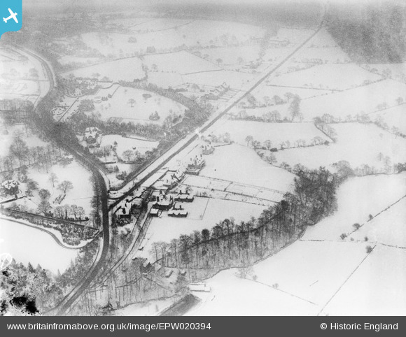
EPW020394 ENGLAND (1928). Housing in the snow around Whirlowdale Road, Whirlow, 1928
© Copyright OpenStreetMap contributors and licensed by the OpenStreetMap Foundation. 2026. Cartography is licensed as CC BY-SA.
Nearby Images (10)
EPW020394

EPW020397

EPW020392

EAW042407

EAW042401

EAW042402

EAW042408

EAW042405

EAW042403
, Whirlow, 1952. This image has been produced from a damaged negative.")
EAW042404
, Whirlow, 1952. This image has been produced from a damaged negative.")
Details
| Title | [EPW020394] Housing in the snow around Whirlowdale Road, Whirlow, 1928 |
| Reference | EPW020394 |
| Date | March-1928 |
| Link | |
| Place name | WHIRLOW |
| Parish | |
| District | |
| Country | ENGLAND |
| Easting / Northing | 431397, 382657 |
| Longitude / Latitude | -1.5284033055647, 53.339613787546 |
| National Grid Reference | SK314827 |
Pins
Be the first to add a comment to this image!